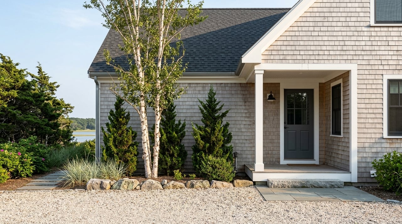
Dreaming about coastal Maine, but not sure what daily life really looks like once you move beyond the postcard view? Freeport’s Harraseeket neighborhoods offer a mix of harbor activity, quiet shoreline pockets, historic village character, and tide-shaped routines that can feel very different from one area to the next. If you are considering a move, a second home, or simply narrowing your search in Freeport, this guide will help you understand how the Harraseeket shoreline lives day to day. Let’s dive in.
What coastal living means here
Freeport’s Harraseeket area is not one continuous waterfront neighborhood. The town describes Freeport as having 37 miles of tidal coastline, with the Harraseeket River serving as its primary deepwater harbor and one of the more protected anchorages in Casco Bay. That gives the area a strong coastal identity, but it also means your experience can vary widely depending on where you are.
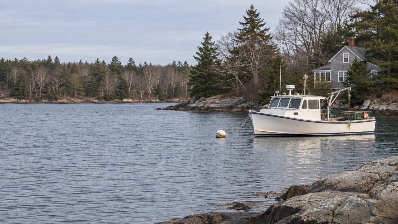
Along this shoreline, you will find rocky coast, estuaries, clam flats, inhabited islands, and an active harbor. In practical terms, that means coastal living here is shaped as much by working-waterfront use and changing tides as by scenic views. If you are searching for a home in this part of Freeport, it helps to think beyond “waterfront” and focus on how you want to spend your time.
Harraseeket shoreline feel
The Harraseeket shoreline blends maritime activity with small-scale coastal access. Some spots are better for launching a kayak, some are better for walking or swimming, and others are tied more closely to boating, shellfishing, or seasonal recreation. The town’s coastal access map makes clear that access is spread across several small points rather than centered in one main waterfront district.
That distributed layout is part of the appeal. Instead of one busy strip, you get a series of distinct pockets with their own rhythm, scenery, and logistics. For buyers, that often means lifestyle fit matters just as much as square footage or lot lines.
South Freeport and harbor villages
South Freeport, Mast Landing, and Porter’s Landing are some of the most recognizable coastal pockets in the Harraseeket area. Freeport’s historical materials describe them as self-contained villages that later became the Harraseeket Historic District, with Federal and Greek Revival dwellings. South Freeport was historically tied to shipyards, fishing, canning, and farming, and that layered past still shapes the area today.
You can still feel that harbor-centered identity in the way access works here. The Town Dock offers limited parking and short-term tie-up, while Dunning’s Boat Yard at Porter’s Landing supports canoe and kayak access. Cove Road and Mast Landing also provide shoreline access, though some use is tide-dependent.
If you are drawn to places with visible marine activity and a stronger sense of historic harbor life, this part of Freeport may stand out. It tends to feel more distinctly maritime than inland sections of town, with the tradeoff that access, traffic, and convenience can shift with the season.
Pettengill Farm adds open space
One of the quieter features of this area is Pettengill Farm on Flying Point Road. The town’s historical report describes it as a 19th-century salt-water farm that is open year-round from dawn to dusk. That adds a pastoral layer to the coastal setting and gives this stretch of Freeport a mix of harbor views, historic landscape, and open land.
For some buyers, that combination is exactly the draw. You are not choosing between village history and coastal scenery. In parts of Harraseeket, you get both in close reach.
Staples Point and Winslow Park
If your ideal coastal lifestyle includes regular outdoor time, Winslow Park is a major landmark to know. The park sits at the end of Staples Point Road on a peninsula between Casco Bay and the Harraseeket River. According to the town, it includes a tidal beach, boat launch, trails, campsites, and a summer concert series.
Winslow Park is open every day of the year, which makes it relevant well beyond summer. During the colder months, the park still offers playground access and hiking or jogging trails, with cross-country skiing and snowshoeing available when conditions allow. That year-round access can be meaningful if you want coastal living that stays active in every season.
Expect a busier summer pattern
Summer brings the highest level of activity here. Winslow Park charges summer day-use fees and hosts concerts, and the Town Dock is also noted by the town as very busy during summer months. If you love energy and seasonal activity, that may feel like a benefit.
If you prefer a quieter daily routine, it is worth understanding that some shoreline areas change noticeably between February and July. In coastal Freeport, seasonality is part of the lifestyle, not a side note.
Cove Road, Little River, and Sandy Beach
Another defining feature of the Harraseeket area is how many small access points are woven into the shoreline. Freeport’s public access map includes Cove Road, Little River, Old County Road, Sandy Beach, Town Dock, Mast Landing, Dunning’s Boat Yard, and Winslow Park. Together, they create a coastal experience that feels varied and local rather than centralized.
Little River, near Wolfe’s Neck Farm, is described by the town as a popular place for swimming and clamming. Sandy Beach offers another shoreline experience, though it is a steep beach accessed by stairs. Cove Road has year-round parking, but the ramp and float are removed in winter, and larger craft are limited by tide.
These details matter if you are trying to picture everyday use. A home that looks close to the water on a map may still involve seasonal access changes, tide timing, or limited parking at nearby launch points. Knowing that upfront helps you choose a location that fits how you actually want to live.
Wolfe’s Neck and the nature side
Wolfe’s Neck Woods State Park adds a strong nature element to the Harraseeket shoreline. The state describes five miles of trails through woods, along the Harraseeket River, and beside rocky Casco Bay shoreline. Park materials also note osprey nesting in early summer, which speaks to the area’s active coastal ecology.
The town notes that the park is about a five-minute drive from Freeport’s shopping district, with an approach that passes marshes and open fields. That contrast is part of what makes this section of Freeport distinctive. You can move quickly between village convenience and a more natural, shoreline setting.
Working waterfront realities
A big part of Harraseeket living is understanding that this is not only a scenic coast. It is also a managed marine environment. The Harbor Master oversees moorings, waterfront structures, shellfish enforcement, and coordination with the Coastal Waters Commission.
The Harbor Master page also notes water testing in tidal areas, opening and closing shellfish harvest areas, and a local prohibition on night shellfish harvesting. If boating or shellfishing is part of your interest in the area, those rules are not minor details. They are part of the real day-to-day framework of living near the harbor.
Boating and shellfishing follow local calendars
If you are planning around waterfront use, timing matters. Mooring applications are due by March 1. Shellfish licenses run from July 1 through June 30, with commercial shellfish licenses renewing in April and recreational shellfish applications opening in June and reopening for non-residents in late September.
This is one reason buyers often benefit from neighborhood-specific guidance rather than a broad coastal search. In Harraseeket, the practical side of access can be just as important as the visual side.
Coastal versus inland Freeport
One of the most useful ways to think about Harraseeket neighborhoods is to compare them with inland Freeport. The town’s 2025 Comprehensive Plan emphasizes conserving coastal beauty, historic character, rural landscapes, and recreational assets, while focusing more concentrated growth in the Downtown Village and parts of the Route 1 corridor. That helps explain why different parts of town feel so distinct.
Closer to Downtown Village and Route 1, you have more year-round activity, including shops, restaurants, lodging, and other services. The Village Corridor Initiative is aimed at walking, biking, transit, economic opportunity, and new housing in that corridor. For many buyers, that means easier access to everyday amenities.
Farther south and along the shoreline pockets, the tradeoff often shifts toward water access, maritime character, and a more tide-sensitive routine. Neither option is better across the board. It depends on whether you want your Freeport lifestyle to revolve more around harbor access or around village convenience.
Inland Freeport has a different pace
Inland Freeport tends to feel more rural and trail-oriented. The town describes thousands of acres of conserved land and outdoor networks in both East Freeport and South Freeport. The East Freeport Trail Network includes 8.5 miles of wooded trails across 504 acres, while the South Freeport Trails cover 4 miles through woods and mowed fields.
That gives inland areas a quieter, lower-intensity feel than the harbor edge. If your version of coastal Maine is more about woods, fields, and conservation land than about docks and launch schedules, inland Freeport may be worth comparing closely with Harraseeket neighborhoods.
What buyers should weigh
If you are exploring coastal living in Freeport’s Harraseeket neighborhoods, a few questions can help sharpen your search:
- Do you want harbor activity nearby, or a quieter setting with occasional access?
- How important is proximity to Downtown Village and Route 1 services?
- Would you use parks, trails, beaches, or launch points year-round or mostly in summer?
- Are tide-sensitive access points a good fit for your routine?
- Do you want a more historic village feel, a nature-oriented setting, or a mix of both?
In this part of Freeport, those answers often matter more than the general label of “coastal.” The shoreline is compact, varied, and highly place-specific.
If you are considering a move to Freeport or comparing coastal neighborhoods across Greater Portland, working with a team that understands how these small location differences shape daily life can make your search much more productive. McFarlane Field Associates helps buyers and sellers navigate Coastal Maine with clear local guidance, thoughtful strategy, and a steady process from first tour to closing.
FAQs
What is the Harraseeket area in Freeport like?
- The Harraseeket area is a mix of harbor activity, rocky shoreline, estuaries, clam flats, historic village pockets, and scattered public access points rather than one continuous waterfront strip.
What are the main coastal neighborhoods near the Harraseeket shoreline?
- Key coastal pockets include South Freeport, Mast Landing, Porter’s Landing, Staples Point, Cove Road, Little River, Sandy Beach, and the areas near Wolfe’s Neck and Winslow Park.
What should home buyers know about shoreline access in Freeport?
- Many access points are tide-sensitive, some have limited parking, and the Town Dock is especially busy in summer, so access can vary by season and location.
What makes Winslow Park important for coastal living in Freeport?
- Winslow Park offers a tidal beach, boat launch, trails, campsites, and seasonal events, and it stays open year-round for outdoor use.
What is the difference between coastal and inland Freeport?
- Coastal Freeport is more tied to harbor life, tides, and marine recreation, while inland Freeport tends to feel more rural, trail-oriented, and lower-intensity in daily logistics.
What should boaters and shellfish users know about Harraseeket living?
- Boating and shellfishing are shaped by local rules and schedules, including March 1 mooring application deadlines, shellfish license cycles, water testing, and harvest-area openings and closings.